
It is a long established fact that a reader will be distracted by the readable content of a page when looking at its layout. The point of using Lorem Ipsum is that it has a more-or-less normal distribution of letters, as opposed to using ‘Content here, content here’, making it look like readable English. Many desktop publishing packages and web page editors now use Lorem Ipsum as their default model text, and a search for ‘lorem ipsum’ will uncover many web sites still in their infancy. Various versions have evolved over the years, sometimes by accident, sometimes on purpose (injected humour and the like).
Category: Oliver-Post
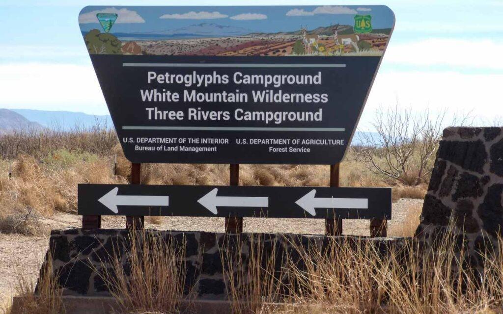
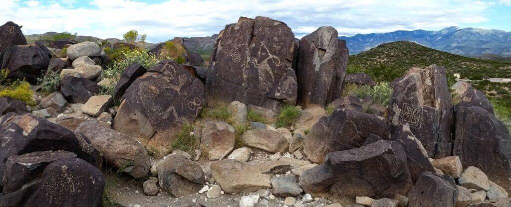
Three Rivers Petroglyph Site

An Ancient Story Etched in Stone
November 17, 2023 | Visit Alamogordo | Original Article
If you are looking for a fun and interesting day trip, Three Rivers Petroglyph Site is an oft-overlooked archaeological treasure. Located off US-54, approximately 35-miles north of Alamogordo, the 50-acre site is one of the largest and most interesting petroglyph sites in the Southwest, providing visitors with a hike through the past. Walking the trails and exploring the images is like peering through the veil of time.
The late afternoon is peaceful. There usually aren’t many people on the trails later in the day. The temperature drops as the sun descends to the horizon. If the wind isn’t blowing, it gets very quiet, with the ebbing rays of light illuminating the petroglyphs on the west side of the ridge. The images on the dark boulders command attention, though the meaning is left to the imagination.
There are two trails. The Petroglyph Trail is a rugged 1/2-mile trail that starts at the visitor center, ascending to the ridge of boulders. The village trail is a short, well-marked interpretative trail south of the petroglyphs. It leads to the remains of an ancient village, occupied from 1800 BC – 300 AD.
Perusing the Petroglyphs
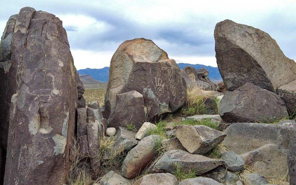
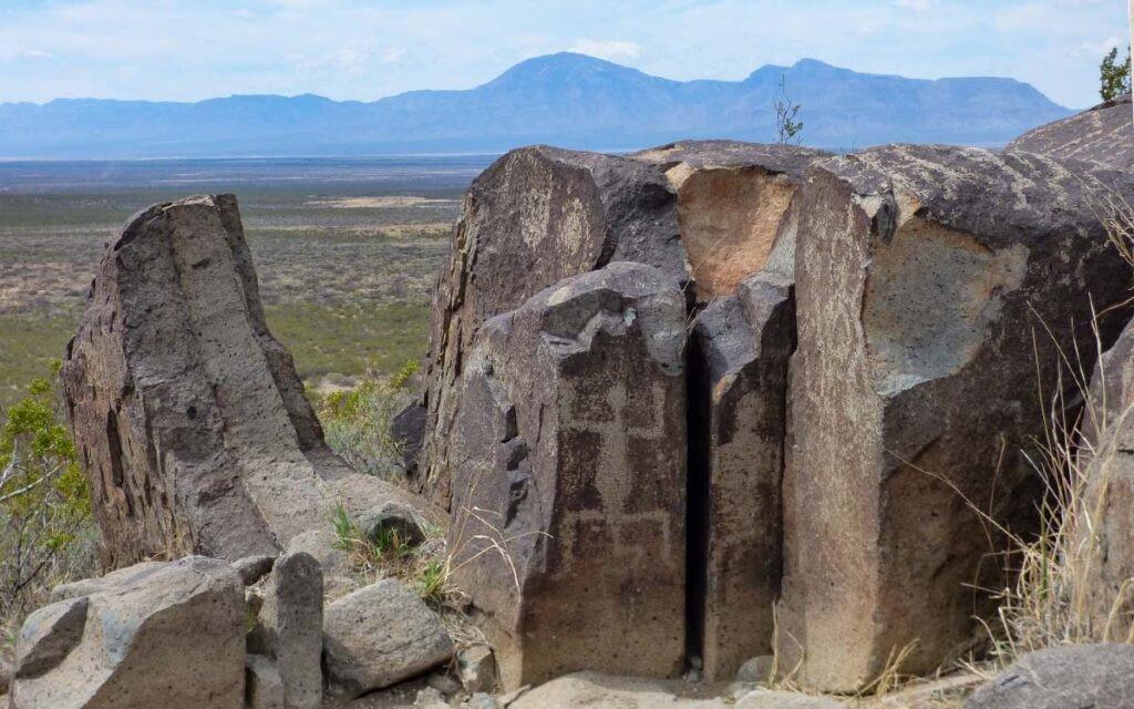
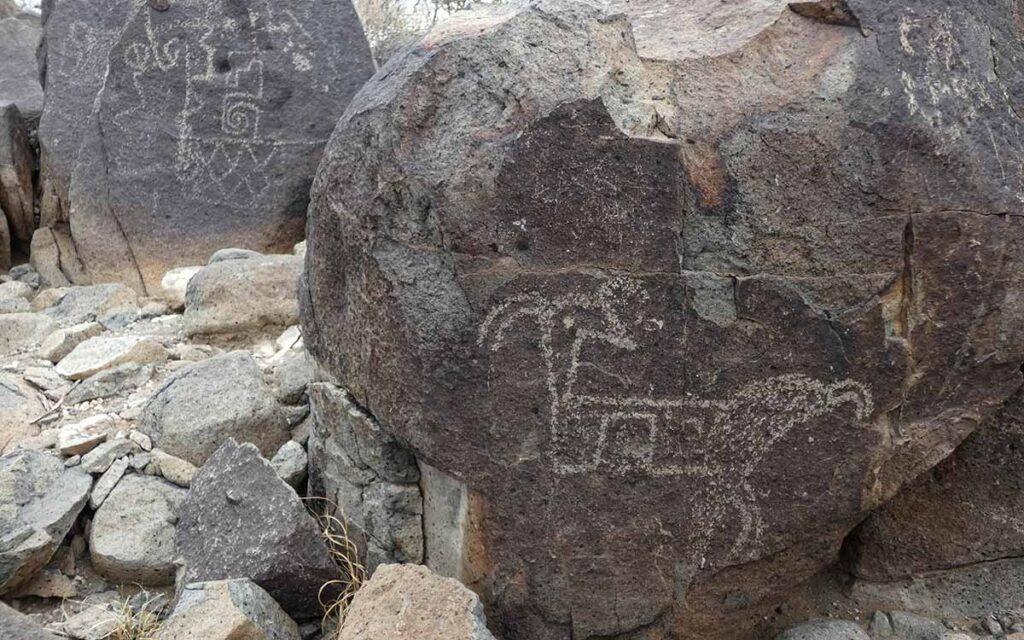
There are more than 21,000 images etched into basalt boulders lining a low ridge in the shadow of Sierra Blanca, the tallest peak in the Sacramento Mountains. Whereas the meaning and purpose of the images is debated by archaeologists, the story they convey to visitors provides a visceral connection to the people who lived in this area long ago.
Based on excavations at the site in 1976, archaeologists credit the depictions of humans, birds, masks, fish, insects, plants, sun bursts, shields, geometric, and abstract designs to the Mogollon. They found numerous artifacts during the excavation, as well as the ruins of an ancient settlement, with three distinct types of prehistoric structures. They believe the site was occupied for at least four centuries.
Messages from the Jornada Mogollon
The Mogollon was one of three civilizations that dominated the cultural evolution of the Southwest. Although similar in many ways to both the Ancestral Puebloans, the Mogollon retained distinct cultural differences, including a unique pottery style, differences in ceremonial architecture, and variations in construction techniques. Mogollon settlements were usually near mountain and canyon country. Though specific borders are unknown, their area of influence spanned 400 miles east-west and up to 500 miles north-south.
Archaeological research on the Mogollon led to the recognition of several sub-groups, including the Mimbres, the Jornada, Forestdale, Reserve, Point of Pines (or “Black River”), San Simon, and Upper Gila branches. The petroglyphs at Three Rivers are attributed to the Jornada Mogollon. The village site at Three Rivers is on the eastern perimeter of their territory.
The name “Jornada” is a reference to the Jornado del Muerto (journey of death); a dry, desolate stretch of the Camino Real traveled by early Spanish conquistadors, as well as settlers traveling between El Paso and Santa Fe.
Settlers in the Tularosa Basin named the site based on three streams that converge there: Indian Creek, Golondrina Creek, and Three Rivers. If you are planning to hike both trails, pack for the day. Take lots of water, a hat, good hiking boots or shoes, sunscreen, and a walking stick.
There isn’t much shade available. In the summer, it is a good idea to start the hike early in the morning to avoid peak heat. Watch for snakes between April and October. During the summer months, the snakes are more active when it is cooler, i.e. morning and evening. You are more likely to see them near the trails.
Directions
the site is located 35 miles north of Alamogordo on U.S. 54. Turn east from U.S. 54 at Three Rivers onto County Road B30, which is next to the Three Rivers Trading Post. The county road is paved. The site is approximately five miles from the turnoff. It is well marked.
Camping
there are five shelter sites available, with picnic tables and cooking grills. One is handicap accessible. There is one group site with three picnic tables under a shelter and two grills, as well as two RV sites with covered picnic tables, grills, water, and electric hookups. There are five tent sites. One is located adjacent to the handicap accessible site. Restrooms and drinking water are available. Pets are allowed in the campground (on leash); however, pets are not allowed on the trails.
Season/Hours
Open year-round. From April to October, the entrance gate is open from 8 AM – 7 PM. From October until April, it is open from 8 AM to 5 PM. Non-campers must be out by 10 PM.
Fees
Day Use (per vehicle) – $5
Camping (per campsite) – $7
RV Hookup (per campsite) – $18
Day Use (Bus) – $15
Group Site (per group) – $50
Las Cruces District Office Day Use Pass – $30
Las Cruces Field Office
1800 Marquess Street
Las Cruces, NM 88005
(575) 525-4300